15 May, 2013

Maine Lobster & the Other Portland


Entering New Hampshire (I think)
After surviving the cold night in Vermont’s bear country, we fumbled to pack up the tent (of course, we didn’t think to bring gloves for camping in mid-May..). We followed the winding roads, littered with empty ski resorts and bed and breakfasts, and made our way further east. It didn’t take long to get to New Hampshire, and Maine shortly followed.

One of our first waterfront views in Maine
For hitting three states in one day, we didn’t spend too much time driving, and ended up getting to Portland around 10:30 or 11, which allowed us time to explore the Arts District down town, stopping mostly in comic book shops. (You see, I have very little self-control when spending money, so I let Marc take over..) Marc traded some zines for more comic books and a couple of VHS tapes at a really cool little music/movie/comic book shop along the popular Congress Street called “Strange Maine”. Then came the highlight of our day: lunch!
Becky's Diner- A legitimate, delicious diner
We have been excited for the abundance of great food that we will hit along the way. Since we cut our budget, we did have to cut out some of our food budget, but we made sure to leave a healthy portion for Maine lobster, and boy, did we have Maine lobster!! We visited a cute little diner called Becky’s Diner, which was closer to the coast than the Arts District. We later figured out that the diner was featured on Diners, Drive-In, and Dives, and it really didn’t come as much of a surprise. The food was great (we had a lobster roll, and fried Haddock (fish)). Both were fresh from the ocean, and were delicious! We were tempted to blow our entire budget there for the rest of our stay in the area, but just barely resisted (they also had some delicious looking blueberry muffins sitting on the counter, and as I was reminded, Maine is also famous for their blueberries).
Lobster Roll at Becky's Diner
We made an early exit from downtown to our campsite after reaching our limit for window shopping for the day. We also were surprised to encounter quite a few homeless in the downtown area, prompting a quick walking pace back to the car. On a side note, Portland, Maine is an extremely dog-friendly town, and seeing all of the dogs and dog-directed businesses made us miss our puppies quite a bit! To ensure that we were in a good location, close to our activities for our time in Maine, we booked a paid campsite (our first for the trip), and got there with no issues. It also surprised us with a BATH HOUSE! I have never been so excited to see a crappy little shower as I was at that moment. We each took some time and showered for the first time since Ohio (yikes!) and… oh my goodness, did it feel amazing! Refreshed, we got caught up on drawing, writing postcards, updating the blog, and paying bills. We even got the air mattress blown up with no more issues!! :)
Camping Site set up at Wassamki Springs in Scarborough, ME (just south of Portland). We even got a water and electrical hookup!
-Allie

14 May, 2013

Cobleskull and Bear Country

Yesterday, we drove across New York State into Vermont.
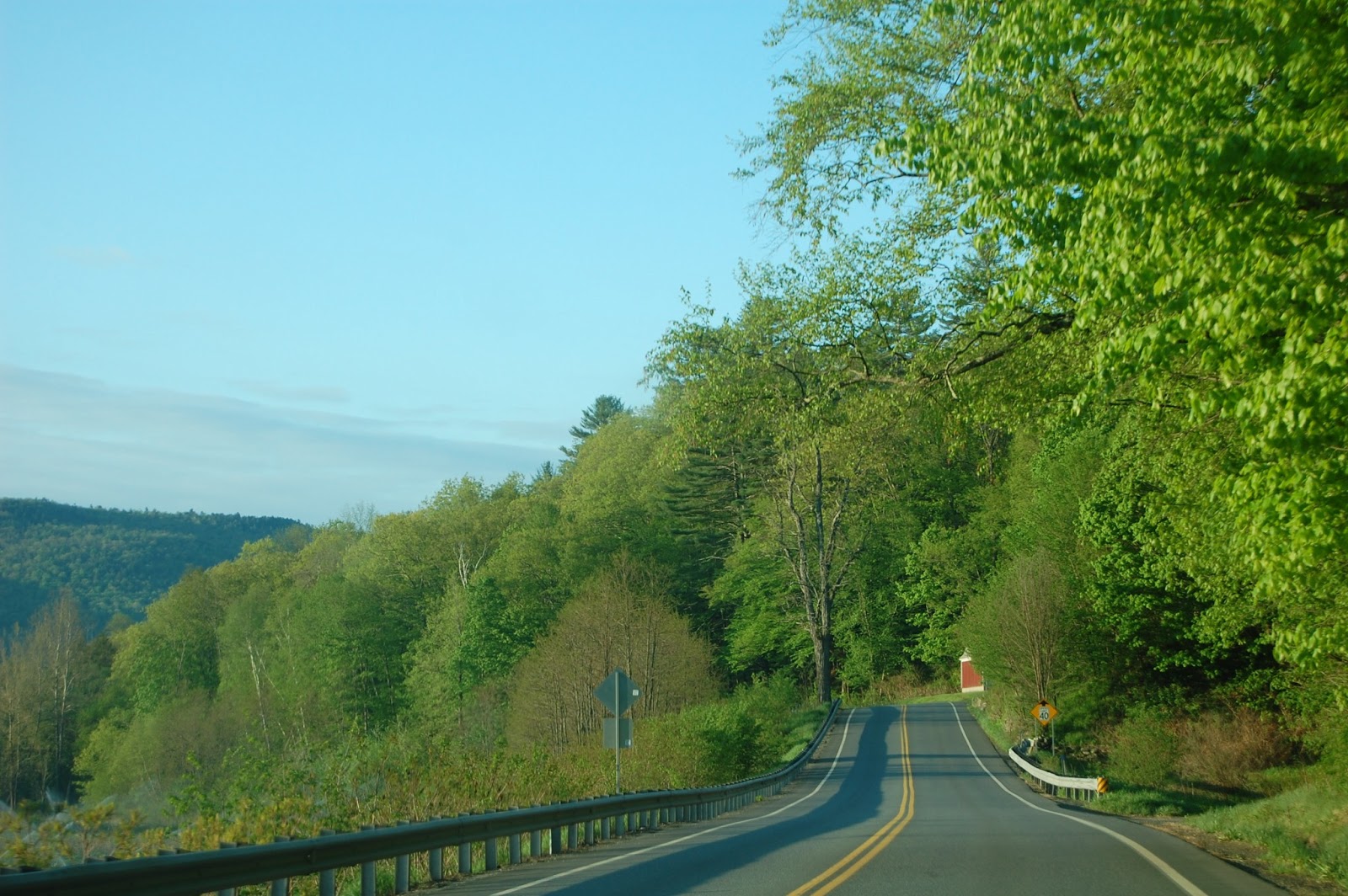
The view upon entering Vermont, it was literally breathtaking. As I was driving, I had to take a breath and just say "oh my god". This picture really doesn't do it justice. -allie

This was a shorter drive then we were used to. We took a nice break in Cobleskill, New York (Which I kept calling Cobleskull.) It is a little college town that reminded us of Brookings. After a few days of camping, it was time to replenish our food supplies. We stopped into a grocery store called “Chopping Prices.” Contrary to what I thought, you are not supposed to karate chop things to make them cheaper. We ventured on with a bag full of fruits and veggies.  For lunch we splurged on a local establishment called “Burger King”. If you are ever in Cobleskill, I suggest you give this place a try.

In Cobleskill, NY

In Cobleskill, NY

In Cobleskill, NY


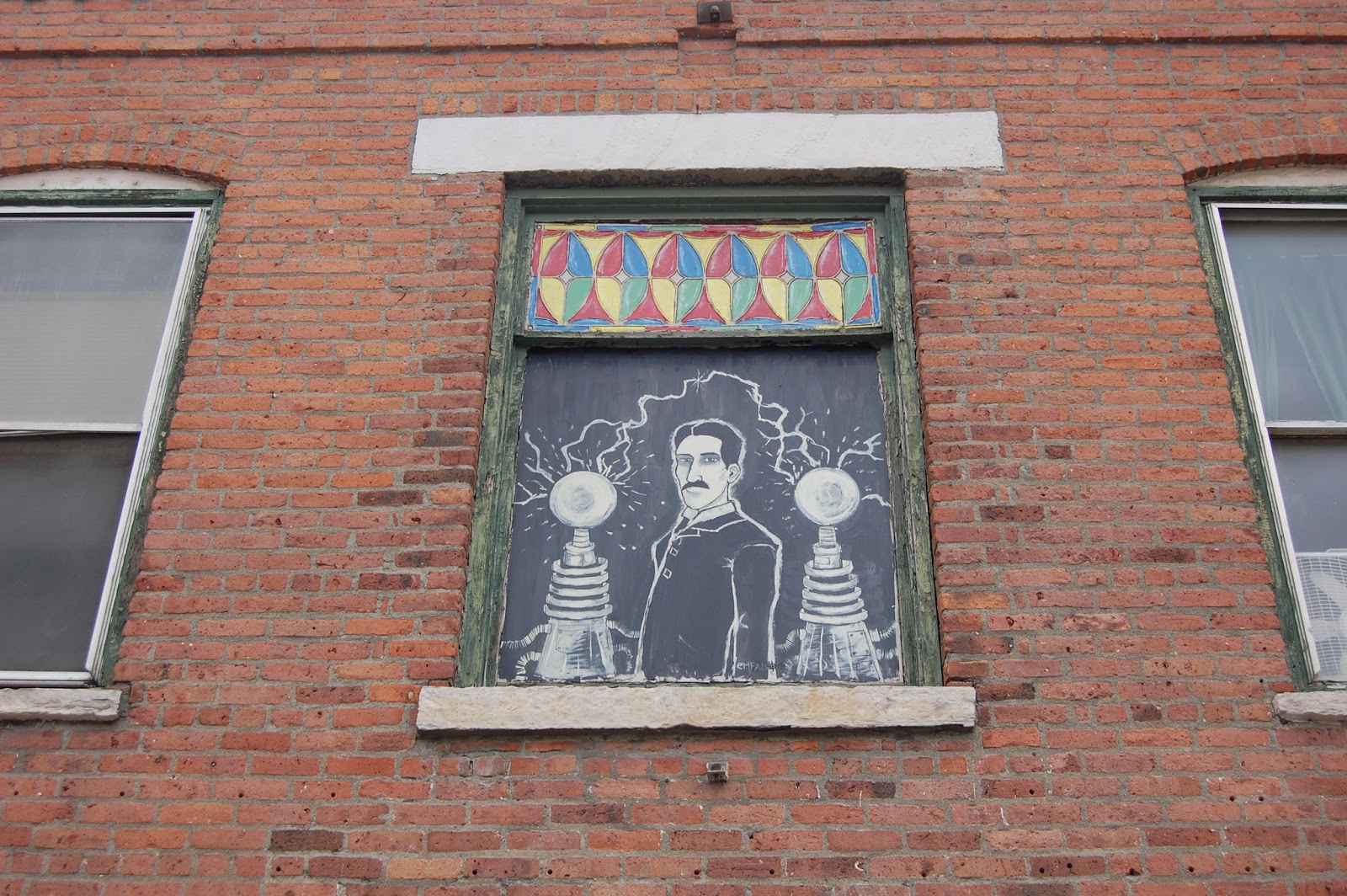
The weather was cooperating, so we decided to take a stroll around town. Cobleskill has many beautiful old buildings and hand painted signs. Our personal favorite was of the Robin Hood Flour logo. Another building had several murals on it. One of them was of Nikola Tesla! Upon closer examination, the building was a comic book store. Unfortunately, they are closed on Mondays. After that we hopped back on the road.
Throughout our trip we have had a hard time finding our campsites. Yesterday we had an especially hard time. Our first attempt at finding the site was halted by a large pile of rocks blocking our path. After an hour long detour, we thought we had arrived. Nope. A drive down a winding gravel road was met with the same result. Finally, we found the correct path that led us to Grout Pond. I can honestly say it was worth the trouble it took getting there. The scenery was absolutely breathtaking.
A CRICK we drove along for part of the 2 hour trip that finally ended at our campsite
After a hot meal it was time to set up camp. We pitched our tent on the bank of Grout Pond. At the time, I was unaware that we were in bear country. You see, I have a fear of large animals that are capable of eating me. Luckily during our stay we didn’t encounter any.
Last night was another cold camping experience. One the locals even commented that “winter’s back.” Upon learning that we were from South Dakota, he joked that we must be used to this weather. Perhaps he was right, but that doesn’t mean we enjoy it. The temperature that night was below freezing, and we had not prepared for it. An unfortunate accident also left us with a hole in our air mattress. (It was Allison. She was goofing around and I warned her it would pop a hole in the air mattress.) Luckily Allison has was able to fix the hole (that she caused.) Last night was without a doubt the hardest so far. But it really wasn’t all bad.

Vermont is a beautiful state. I hope we get the chance to return someday.

We got camp set up rather nicely
Fixing the hole in the mattress... (yes, I did that...) -allie
I did feel really bad about breaking the mattress... :(
View sitting in our tent
-Marc

13 May, 2013

Niagara Falls & Goat Island


An early start

Yesterday, we woke up early (it wasn’t too hard, considering it was a cool 30 degrees in our tent), packed up the tent, and headed back to Niagara Falls, this time getting there at about 7:30am, which saved us the $10 parking fee (free before 8am!!), AND gave us a beautiful, unobstructed view of the falls, since the only other people there were a few cars of visitors, and a bus of Asian tourists. We went back to the main falls viewing area later to find it packed and very busy, so we were pretty proud of ourselves for beating the rush! We spent our morning exploring the falls, making our way over to Goat Island to explore more, and see the falls right beside the famous Niagara Falls, known as Horseshoe Falls. Personally, I thought the two were equally awesome. Horseshoe Falls was more of a trek to get to, and when we got near the viewing area, we were instantly drenched in the mist from the falls (no need for a Maid of the Mist trip for us!). An interesting side note: while on Goat Island, both of our phones welcomed us to Canada and warned us about the ridiculous fees for phone calls and such, so you could say that we kind of went to Canada…
We got some really pretty pictures of rainbows at the falls

Water FALL
Different Angle, another rainbow. See how few people there are? We rocked timing this day.
In front of Horseshoe Falls- this mist was constant near the falls.
We also made our way over to the Niagara Gorge hiking trails, which varied in difficulty. Obviously, the harder ones sounded like they had the coolest views (including a whirlpool… whaaat?!), but we didn’t really want to put ourselves in a position to have to go “boulder hopping”.. We aren’t THAT good.. haha.
But we did find a trail marked as easy/moderate, and followed it for quite a ways. The gorge is also a really beautiful place, it is basically the huge valley of the Niagara River after the falls. At some points, you can get a different view of the falls, but for the most part, you really just see the gorge and the river.
On our way to the hiking trails, we checked out the Rainbow Bridge- Canada is on the other side
Off the beaten path- didn't stay here long, because we started to feel woozy with the fear of falling, but it was an absolutely beautiful view. (Rainbow Bridge and Niagara Falls)

Hiking at the gorge, we looked up, and realized we were a little ways down into the gorge.  

For lunch, we decided to follow the crowds and head across the street to the huge tourist trap with an “International Food Court” and “Made in USA Souvenirs.” Each section of the food court was labeled with a “cuisine”. The signs literally said Indian, Chinese, American, Nigerian, Japanese, Italian, and Greece. The American food, of course, was hamburgers, hot dogs, and French fries. We had Indian, which was pretty good, for food court food. It was a lot of fun to people-watch, as you could clearly look at each section and see how the other tourists went directly to their country of origin for lunch. The souvenir section also gave us a chuckle, as it was mainly YOLO shirts, and other crappy ‘USA’ stuff.
Tourist Trap/Food Court Across the Street from Niagara Falls
We also spent a good 5 minutes on a bridge, watching this seagull trying to get a dead fish out of the water, and then eating the fish. He had quite the time, it was a big fish!
We decided to head back to the campsite and relax for a while, update the blog, and set up camp early.
Again, Niagara Falls, also, it was really cold out.
We got the tent set up just long enough to let it dry from the night before, then checked the weather, and saw that we had rain, snow, and 35mph winds. We decided to pack up the tent and sleep in the car, as the tent was bending and flopping right away. I feel kind of like we sissy-ed out, but I’m pretty alright with it. When we woke up this morning, there was a layer of ice on the car, and the snow/freezing rain had actually started to stick to the grass. Unfortunately, tonight’s forecast for Vermont looks pretty similar, so we will have to see how that all goes tonight.
12 May, 2013

Ashtabula Bridges


By day two I could already tell we were getting a handle on things. After learning our lesson, we avoided toll roads in favor of a more scenic route. This small change saved us money and headaches. The highways also provided us with beautiful scenery. It was very different from the flat terrain we are used to in South Dakota. The roads twist and turn, going up and down. The first part of our day took us from Toledo, Ohio to Ashtabula County, Ohio. 
Ashtabula is famous for its beautiful covered bridges and award-winning wineries. There were plenty of beautiful sights to be seen. We spent some time exploring the area before moving on, including the longest covered bridge in the United States (Smolen-Gulf Bridge)
Smolen-Gulf Bridge

I can't remember the name of this bridge, maybe Center Street Bridge?
us, hanging out by the big bridge! :)
From Ashtabula, we began our journey to Niagara Falls, New York. The drive was much shorter than the previous day. In the late afternoon we arrived in Niagara Falls. Our original plan was to explore the park for a few hours and then head to our camp group. We were scared off by the $10 parking fees and heavy traffic. We left Niagara Falls and headed for our camp site. 
The only problem was we weren't exactly sure where our campsite was. After driving around for quite some time, we finally settled on a spot. Even now we are unsure if the spot was our destination, but it worked out. We rushed to assemble the tent as storm clouds accumulated overhead. Practicing setting up the tent came in handy. After a busy two days, we settled down for a good night’s sleep, anxious to return to Niagara Falls in the morning. 


Bonus photo

-Marc

Driving, Deep-Dish Pizza, and Lessons Learned

First off: Ah!! It’s actually happening! We are ON a road trip!!:D

So. Since we shortened our trip, yesterday became a huge driving day for us. It also significantly shortened our time in Chicago, which is a bummer, but we figured we can visit Chicago more easily than most of our other stops. Yesterday was also  what we hope to be the beginning of a huge learning curve..!
Yesterday we ended up beginning our drive at 5.30am arriving at our hotel at 11pm. Granted, we did make some stops, but we also made a lot of mistakes that added unnecessary time to our schedule (more about those later… J). We took I-90 east, passing through Minnesota and Illinois, hitting Chicago, passing through Indiana, and ending near Toledo, Ohio.
Our view of downtown Chicago 

While we didn’t get to stop in downtown Chicago, we did stop in a suburb for Lou Malnati’s Chicago-style pizza, which was deeelicious! We also gave ourselves the opportunity to hit the bulk of Chicago rush-hour traffic… haha. The thing about the traffic though, was that it really did give us a chance to see some Chicago highlights, at a nice, slow pace. So it wasn’t all bad! 
The dreaded toll bridge


As for our learning curve… this is where our trip turned from what should have taken 13 hours, plus stops to 18 hours. We realized too late that we had taken too much time at the beginning of the day and would be hitting Chicago during rush-hour. We also dropped about $20 on tolls. Even though I knew there were some tolls in and around Chicago, I was too niave to take them seriously. I also didn’t realize that our GPS had an option to avoid toll roads. I figured a dollar here, a dollar there, we would be just fine! Then, we got to Indiana, and by the time we left 2 hours later, owed $7.70, just for driving on their roads, which was our last straw. We looked at the GPS, found the “Avoid Tolls” button, and upon entering Ohio, switched to the side roads. Mistake! By that time, it was dark, it was rainy, and the roads were very small and seemed secluded. We only lasted a few minutes before getting back on the Ohio turnpike and shelling out another $2.25. This morning, we learned our lesson and started early with “Avoid Tolls” button checked, so it’s been smooth sailing.
Indiana was a bit dreary, full of fog.
-Allie

08 May, 2013

Ready.. Set..

As we waterproof the tent, get our bills paid up, and go for last minute shopping trips (quick, write can opener on the list before we forget about it again!), it is becoming more and more apparent that we are leaving... in 2 days!
While it has been a busy last week with moving, Marc graduating, and getting ready to leave for a road trip, we are so ready to continue on with our next adventure. We have done enough planning to make us sick of it, so with a few exceptions, we will likely be researching our destinations and attractions on the way there, and flying by the seats of our pants.
Short post today, but soon enough, you'll be sick of reading all about our amazing adventures.. ;)

23 April, 2013

Planning Resources

I want to take some time to share the resources that we have found particularly helpful so far during our planning process in case anyone is interested. (Also, I really needed a break from school work, studying for finals, and packing, so I figured, what better than a blog post?!)
We decided to plan a bit more than some other people might, since we have a relatively short time to see a lot of stuff- 6 weeks goes very quickly when you are making 40 stops! Personally, I would love to just take off 8 weeks and figure it out as we go and roll with the flow.. Maybe next time! ;)
We started our planning with a big old template in Excel. Ours has a lot of columns, but I hid most of them during the early planning, since things shifted so much, and the rows kept moving, so it was easiest to just have to worry about a few columns.
Important first-stage planning columns:

  • Day (numbered days)
  • Date (could also include days of the week)
  • From Location (starting driving point)
  • To Location (ending driving point) 
    • when we visit more than one location per day, I simply made each location a new row and maintained the day number and date for the 2nd row.
  • Trip Time (in hours- know how realistically how long it will take)
These were hidden at first, but I did periodically un-hide and add information if I came across it during my research:
  • Miles (not as important I guess, but I liked having this column. Since I was looking up the time, miles were also given. So I made note of it.)
    • Wait to enter these two until you are fairly confident in your locations, for us, they were kind of time consuming to find.
  • Budget columns- we used 3 
    • Gas budget- Given when finding miles/time from mapquest. 
    • Food budget- at this point- still complete guesses... haha
    • Lodging budget- make sure to include hotels, hostels, campground fees/permits
  • Lodging Plans- to make note of possible campgrounds/hotels/family to stay with
  • Dining Plans- if you are into food like us, we have been researching what and where we want to make sure we don't miss, food-wise
  • Activities- at first, I just researched and noted any and all that we may be interested in- it never hurts to have options
  • Relevant links- hotels/campgrounds/activity passes/maps of national parks, etc..

So. Excel. Super helpful, but obviously not designed for planning road trips. Which is when I turned to a few different websites that include maps, room for making notes, free and cheap campsites, and so on. These are the ones I automatically open in a browser when I sit down to do any road trip planning:

  • myscenicdrives.com- I know I've posted our map from here before. What I cut out of that screenshot was the important side column that included all of the locations pinpointed on the map, and all scenic drives and attractions that we had pinned on the map, as well as directions, time, and mileage. I tried to use mapquest to make an account and get directions and mileage for the entire trip, but failed miserably, so myscenicdrives really took over from there.
  • tripit.com- This is a website/app combo that we just recently got into. Once we got our plans pretty solidified, I could transfer a lot of the information from the excel spreadsheet onto this site. It is fairly useful for a road trip, but has much more to offer- it searches your e-mail for any kind of hotel/flight/activity confirmations and imports them and allows you to differentiate between business and personal trips. Basically, it does a lot more than what we need, but it's pretty cool, because we can access our plans easily from either of our phones, and share with anyone interested. 
  • freecampsites.net- This site is really great, especially for low-budget, camping-heavy road trips. It does take some time and research, but it gives lots of user-reported free and cheap camping options throughout the US. It helped us choose our end points for many days, based on where the nearest cheap or free campgrounds nearby are. Just make sure you take a look to see if there are comments available- it is a 'network' not a company, so all entries are from users, and some don't exist or are different from the initial description.. The comments usually will mention these things and let you know how the campsites were. 

We do have links available for our trip on both of these websites if you want to see them (just let Allison know!), but since anyone can see this and there are creepy people in this world, I am not going to post our every move and sleeping location on this blog for the world to see. :)

I also have found many resources on Pinterest, including packing lists, good road trip food to pack, and ways to save money, and so on. 

We will have to update after the trip, and hopefully share more helpful hints and see how well all of these resources worked.. I guess at this point, it's all still theory as to what will actually be helpful once we leave home. :)

-Allie